Trail History (VIC)

Healesville, 70km east of Melbourne, is the southern starting point of the BNT. It was named after a Victorian premier from the mid 1800's. It started as a single sawmill and has since grown to a town of about 6 thousand people. It has a large range of facilities including several hotels, a shopping centre, police station and hospital, and numerous accommodation choices.
Narbethong is a sort of spread out village along the Maroondah Highway. It is passed through late on day one if making good time on a MTB, or at the start of day two. A hotel and service station/shop plus a few other facilities are available here. I used the postbox outside what looked to be like an old post office. I never did find out what 'narbethong' meant or stood for - sounds like an aboriginal name for something local.
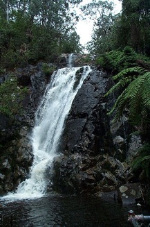
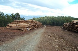
Marysville (quite a European name) is a timber driven town on the way to the Lake Mountain skiing fields. I was quite astounded by the number of ski hire outlets in this little town, as I didn't realise how close it (and Melbourne) was to a snow field. A place with a good feel to it. I dealt with several very friendly and helpful people in the business here. Just outside of Marysville are the Steavenson Falls. These falls are within the Steavenson Falls Natural and Scenic Reserve and are lit at night. (Photos : Steavenson Falls; timber stockpile just south of Marysville)
Not far out of Marysville, and on the BNT, are the Keppel Falls and Keppel’s Hut. I had a schedule to keep to in trying to get to Keppel's Hut and so did not see the falls. A popular destination no doubt as there were 4 mini buses of uni students and about 7 cars at the falls' car park when I arrived and it was drizzling rain. Keppel’s Hut is a great place to camp (if you make it there!) The Keppels (stockmen) used the hut when they drove their cattle and sheep there to graze in the summers during 1900's. It has a really homey feel to it (although restored) - bunk beds, fire place, table and chairs inside and a creek a few metres away for water.
Mt Terrible has a very appropriate name. I haven't heard any trail travelers say anything good about the trip up or down other than that the views and hut facilities at the top are great. 6km of pushing the MTB up to start, followed by pushing partnered with some moderate rolling slopes. Mobile coverage at the top so you can tell all your friends about the struggle, then three evil little 'push up/rock face down' hills before finally some half decent descent tracks. I failed to make it to the very pleasant Knockwood camping area by 6pm and 6km.
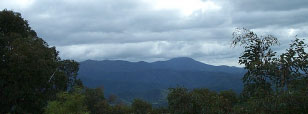
Allow 3hrs for the up and 3 hrs for the down and take your camera. (Photo :' the terrible mountain' shrouded in cloud, 1335m high, photographed after the worst section of Lazarini's Spur. Note 3 little evil hills on the left/south) Also see photos in journal.
Licola is a little village that can be reached from the south via Heyfield or from the north via Jamieson (as I found it).
'All roads lead up' would be a good slogan for this place. It is the 'gateway' to some splendid alpine areas to camp at and explore.
If you come from Mt Skene 45km to the north the last 19km is all downhill - right to the caravan park. Just watch out for the logging trucks, and feel for the warm country air about 7km out.
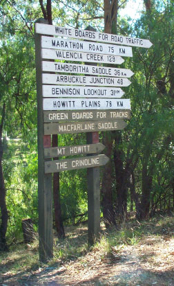
Photo on the left is pointing north out of Licola. The most comprehensive sign I'd seen yet.
It's a steady but not too steep climb up to The Pinnacles. At the East Pinnacle there is a lookout from which a fire spotter spots fires and informs the relevant authorities. I never got the name of this one, but he seemed to be a 'Greg' sort of bloke, so let's call him Greg.
Greg was about half an hour from calling it a day when I showed up. He's a good spotter because he'd seen me getting the bike photo from behind a line of trees. He'd also seen me trying to use my mobile which said it was in range but was not doing what a phone usually does.
For three months of the year spotters man lookouts like this one across the ranges of Western Victoria. There are a fair few of them scattered across the sky's ceiling. Basically when they spot a fire they line it up with a string that runs through the centre of a 1:100 000 map (centre being the Pinnacle) and then read a bearing off a ring of wood with black degree marks running around the top of the windows. You can see round white stickers with place names on the one in the photo below. (Mt Birregun is lined up)
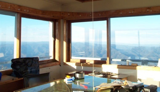
Then all he has to do is estimate the distance and transfer that to the topo map that the string runs through and you've got an estimate of where the fire is. Two-way radio contact is made with the control centre (?) and a cross reference is done from another lookout. This cross reference usually gives a place within a few km at the most.
The first thing I said to Greg was "You get to work with these sort of views as a job?!" He admitted that was the case but also said there were a lot of down points. It's a lonely job and it gives a man time to think. Greg was glad it was only for 3 months a year as any more would drive you nutty. He'd been here for 3 months previously and at another lookout as well, and said that the first few weeks are good but then it becomes hard to stay motivated. The spotters work on call and on this particular day it was for 5 hours.
He had grown skeptical about his role and after hearing his perspective I agreed. His job is really a legality - once a fire gets going in this country its nearly impossible to stop. It burns out or it's rained out. Crews are sent to control or divert fires at the risk of the lives of the fire fighters. The notification aspect for residents is important, but most people can detect a close by fire at ground level and have the common sense to high tail it. Basically the fire crews are sent as a legality - if there is no 'attempt' seen to control a fire then organisations and governments etc. get sued for the losses of individuals. Individuals don't want to take responsibility and (some) legal firms need business and work. The two pair very nicely. That's the case for a lot of things in society now unfortunately.
We continued our discussion on the ills of society on our way back down to more stable ground after I signed the visitors book. He wished me good luck in the ride down Billy Gat Bluff Track and said he'd keep me in mind over the next 3 months. Out of his tank I filled my water bottles with some of the sweetest water I've drunk. He got a mobile call on his analogue (which doesn't work as good as the older analogue ones) and then I waved goodbye to go set up camp.
Oh yeah...the views. Well, just breathtaking. You're 1000m above the underlying valleys and a good 300m higher than most of the ridges. When I was there at 5pm shadows were being cast across the ridges and spurs giving a real 3D effect. Midday isn't so spectacular Greg said. I prompted him for some sunrise/sunset expectations and he said they have an occasional beauty but most were ordinary. As ordinary as they can be at 1445m. I could have stood there and stared for a few hours.
One day out of the months he had been there was classified as 100% visibility. He could see (through binoculars) 6 oil rigs in Bass Strait and a yacht on one of The Lakes... over 150km away to the south. Unreal. He doesn't do a lot when it's foggy. On one particularly nasty day it was 4 degrees C and the wind was blowing at a steady 100km/hr at 10am. I reckon on that day he was running rings around that table because it's only a wooden structure and there's no heating. The air was pretty clean the next day though!
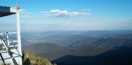
Sometimes I can't believe I got to these places on a bike. Thanks John for putting me onto this place.
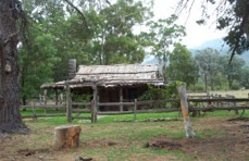
To get to Harry Smith's restored Hut you need to head west for about 55km from Dargo on the Wonnangatta River.
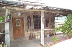
The hut was rebuilt from a rotting slump of wooden beams between 1989 and 1993 by some local blokes. It was opened by an old timer who actually was a friend of Harry Smith
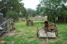
The result is well worth a visit. Outside the hut in the yard is a collection of crop farm machinery. Against the exterior walls lie equipment used in and around the farm, hut and stables of the era. Most in a close to useable condition.
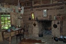
Inside really catches the eye. A collection of books, tea chests, bottles, cooking utensils, bellows, skin floor rugs, cigarette boxes, mirrors and other tid bits line nearly every available space. Most of the walls have been 'wallpapered' with newspapers from the early 20th century. There are some amusing articles to read in a style reminiscent of the times. The accompanying advertisements are also entertaining reading.
Unfortunately I didn't get the story of Harry Smith's life, but I'm not sure that it was available other than by word of mouth. Sandy the caretaker had a quick chat with me but then left me to my own devices. The hut is not advertised other than by word of mouth that I am aware, so don't forget it's there!
During Easter there is a Walnut Festival at Dargo. I'm a bit early for that. It's also got a pub, which is one better than Licola. Dargo is the second last town before you get to use Guidebook 11 of the BNT. If going south to north you can kiss the Vic Alps goodbye!
After 11 days without a cycling break it was time for one. Dargo is the place to have a rest, and the pub is one of a few great places to stay. I stayed in the log cabin out the back of the pub. Heaven made of wood. Country comforts right down to the wool doona and the gate chain toilet roll holder.
This here's a gold and timber town. When the 15 timber mill workers were laid off in 1987 it had a profound effect on the community, so much so that the school has only just reopened with a roll containing just 8 kids. In town there's a bit to do. Me - hopefully I'll be visiting the local school, the winery the teahouse and reading up on the area. Some great guided 4WD packages are available and they are so on the ball that the town has a website. Tours go to fishing, fossicking, historical and natural wonder areas in the locality.
Here are some pictures to whet your appetite for a visit to Dargo.

The local - established 1895. Great character, location, facilities and staff.

The Dargo Store - fuel, groceries, camping supplies, maps and more.
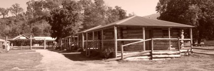
The pub's cabins - country style, convenient and a haven for the weary traveller.
Dogs Grave is an unusual place. Situated just off the road leading to Mt Birregun about 40km SW of Omeo, it is a refreshing site and concept. This was one place I just had to see and had I noted some months ago in the guidebook that I must stop to have a look (being a dog sort of person).
The story goes that this bloke had only his two mates - boney (his dog) and Skinny (his horse) and the hut he lived in. They worked in and around the local area (from memory!). Unfortunately Boney died and so his master buried him and erected a pile of stones in his fond memory.
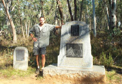
Years later some locals heard of the story and the site and went to find it. The hut that had been there was in ruins, and they had to search around, but the pile of stones marking Boney's grave was still there. A stonemason was motivated by the story and he created a monument to Boney which stands close to his grave, as does a poem on a plaque about the dog written by a Dargo poet. Touching stuff. Wipe your eyes when you tell your dog, because there are many jealous dog ghosts out there.
Just 2km south of Omeo lies the Oriental Claims gold diggings area (see photo at top of page). Omeo was the roughest town in the south in this era before police were introduced to the area. It's settled down a lot since then.
The gold rush brought many miners to the area seeking their fortune. The rush in this particular area and was started when a reverend made a claim. Chinese diggers moved in over time and utilised new techniques to get the gold. BAsically the area had a limited water supply and flow. The Chinese used water diversion techniques and water under pressure to wash away large parts of the river bank so that the soil could then be filtered and panned.
Plenty of reading here and an interesting 40min walk around the diggings loop. You get a real feel for the history of the place and amazement at the hardships that these people faced working in this environment. The Chinese are still predominant in the town - just go to the Hilltop Hotel where they serve Chinese or Australian meals. I went the Chinese and was very glad I did.
Omeo is the kind of place I'd like to retire to if it was in Queensland. Tucked away amongst the hills, friendly and helpful citizens, picturesque, a deep and colourful history, and a licensed supermarket. (I didn't know they existed in Australia.)
After staying the night in the local caravan park which edges the river, I rode around town taking pictures and visiting some of the local attractions. I could have spent another day there as planned, but decided to move on with the good weather. Here are some snap shots (I've plenty more - you'll have to visit Omeo) :

The Court House and the log goal (for a secure night's sleep!)
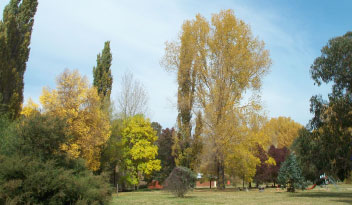
The colours in the Omeo and district trees at this time of year are astounding.
Trail History (VIC)
2/15/09
A little bit of history on some of the places visited in Victoria.
Some of the names may be familiar. For those you don’t recognise, see the Towns Route page for a Google map.
