Week Two (VIC ALBUM LINK)
2001

Arthur's Track to Eaglevale on the Wonnangatta River
Monday 26th March : Arthur’s Creek Tk to 6km from Knockwood
47.9km, 5h 31 min, max 41.5km/hr.
We speak the same language.
A short day to the bottom of Mt Terrible? 20km in total? I'll see what it's like when I get there. I might even take the lower track to avoid the top if the drizzle continues...
When I arrived at 'Ivan's bottom’ it was a sunny day with scattered cloud. It was still early (11am) so I thought "Hell - I'll give it a go, as there will be views from the top." I gave myself 3 hours to get up and three to get down the other side. That seemed reasonable. The guidebook says "In anyone's language it's a tough trip over Mt Terrible".
It's 10km to the top of Terrible. You climb roughly 1000m altitude in that time. [Work out that average % grade.] I pushed my bike for the first 6km and thought at about 3km/hr I was right on track. There was a bit after that on which I actually got to sit on my saddle - it feels so efficient after pushing for so long. Mentally it's hard as well. But with every step up it's a step closer to the top and further than the bottom. And I'd rather go to the top than return to the bottom on any day. The last 1.6km to the top was mostly pushing as well. I had a few attempted mounts only to find myself doing a wheelie or falling off straight away because I couldn't get my cleats to engage quick enough. Developed a sore left calf and got a chunky blister on my right heel. I think my body was trying to tell me that bikes are for riding.
I got to the top in 3 hours and was totally wrecked. I had shed the shirt halfway up but within minutes had to put it back on after reaching the top. Check out the facilities - a tank, full from all that rain!
The views were indeed magnificent. 'Yes Optus' as well! I rang home and texted my sister as well as received voice mail. How convenient - only had to climb the damn thing to be able to do that as everywhere else has been out of range.
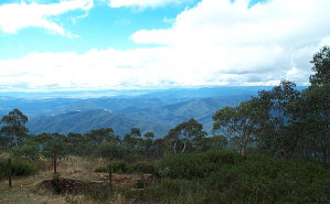
25km down hill in 3 hrs - no problem after that uphill... Well the first bit of downhill I had to sort of walk my bike heaving back so it didn't race down the jagged rock that was apparently a path. Then came three evil little hills as bad as the ones you had to climb on the way up. This slowed me considerably and so became the first incidence of me talking to a mountain in rather unpleasant tones and with socially undesirable content. I told the mountain in no uncertain terms that 'I was meant to be going downhill' and 'why didn't they get a decent surveyor who knew how to build roads on contours' and that sort of thing. I was careful not to lay any blame on my bike, the load, the journey or (of course) myself. None of these parties were responsible for the current problem. I had forgotten about the topo map but if I'd remembered it might have copped an earful too as it showed only one knob. Finally got a bit of decent but rocky downhill. Panniers wanted to jump off all the time so I had to sit on about 8km/hr the whole time. More up hills, but shorter ones with less pushing. There is never a constant down hill in this sort of country - all the amateur surveyors do their work here. I have learnt something important - don't ever think there are no more hills for the day until you are pitching your tent, otherwise you are bound to be disappointed.
My aim was to get to Knockwood which sounded like a great little spot beside the Goulburn River. I tried in vain as a 6:05pm I was about 6km short and wasn't doing to push my bike up the next hill that lay in front of me. I wanted that luxury of a toilet, a place for a campfire and to fish. No go tonight. The campsite I chose was a small flat area between two knobs. The windiest place I have ever camped at.
Slept for 5-6hs then woke for an hour then fell asleep until dawn. A recurring pattern of sleep and I'm not sure why. At present am worried about getting to Dargo with enough food.
Tuesday 27th March : 6km form Knockwood to Knockwood
6.8km, 49 min, max 31km/hr.
A day to recover and have fun.
The day started with a familiar ritual - read/plan the day when first able to see inside the tent until the call of the parc lures me into the fresh morning air. I am tossing up what to do to get to Dargo still and this is constantly on my mind. My left Achilles tendon is sore/left calf weak from pushing the bike up 'Ivan' on awkward angles. I could continue on the trail and risk making it worse or detour to Licola and take a less harsh route. This would avoid trekking injured through some rough country - good sense in anyone's books. Whatever the decision today would be a short ride and rest day at Knockwood by the Goulburn River.
A meagre breakfast in anticipation of the campfire damper and cooked rice and possibly fish. I took my time getting packed and left a bit later, but with a determination to get off this mountain in the least time possible. Carried my panniers up the first knob (which halted my progress yesterday) then went back and pushed the bike up and loaded it at the top. I.D'ed into a small bush coming down a steep rocky part which really woke me up. Forded a creek and then a river in the space of 20m (odd road arrangement) just before arriving at Knockwood. Tossed up how to do this for about 20 seconds then plunged straight through. Shoes soaking wet (and cold) and panniers got a bit of water at the bottom but hey - I'm a mountain biker and I'm tough... and I was able to dry everything a kilometre down the road.
Knockwood camp site is tucked away on a flat piece of ground between the Mansfield - Woods Point Road and the Goulburn River. Well grassed which was really nice to walk about on barefoot - something I hadn't done for about a week. The power lines running the length of the grounds offer a nice touch of civilisation as do the half hourly passing of vehicles on the road. Plenty of bird life. It is apparently a choice (just for the NZ readers) spot to fish and pan for gold.
Filled up my water reserves (not drinking enough in the cool weather) after laying out the gear to dry on the tarp in the fluctuant bursts of sunlight. Organised a campfire and watched it race out of control up the slope and... restrictions? ...it was 30cm across and watched with an eagle's eye... it was damp everywhere due to the rain. Organised a campfire to cook rice which I'd been lugging around but hadn't been able to cook for fear of using all my MSR fuel. Cooked half of it which gave me heaps to snack on and plenty to reheat for dinner. Made damper of questionable quality and burnt it to a lump of charcoal. While doing all this I thought about my personal hygiene. The picture below is a 'roll over' - you work it out... this is a great application to do web pages with - so many cool features. Don't miss the 3rd one!
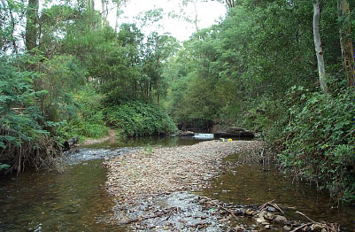
Felt great but it was bloody cold. Was in there for about one minute and used no soap (sorry 7C) and was laughing in a gasping sort of manner the whole time. I also washed my cycling jersey but left my cardboard cycling pants for another day.
Set up the tent as the clouds got a bit menacing in the afternoon. Stitched up my bar bag straps which Mt terrible had claimed as a victim on the rocky descents and impressed myself with my handiwork. Set the fishing line but not really in the best spot to achieve success. Has some rice and ate the bits of damper which were not ugly and drank some tea. Fire left sappy stain all over my big bowl and mug which was nice.
Boy did I need this day off. Everything had helped me to relax and focus on what I was here for and what I was doing. Mt Terrible had hit me as hard mentally as it did physically.
Planned the next few days in late afternoon - up Lazarini's spur tomorrow and try to get to Rumpff Huts by evening, then try to get to Licola the following day either retracing a bit or going along another BNT trail ridge. I need to find out what it's like on the rest of the way to Dargo. Hopefully I can get to top of Mt Skene to use phone again - it's a bit taller than Mt Terrible at 1570m elevation. After Licola I might go back up to and injury status.
Got fire going again to reheat rice and add flavours. Retried making damper (with sultana, Sustagen and cocoa) and cooked a little more cautiously, and made some more tea. Rice was very filling and I was more stuffed than a Thanksgiving Turkey after it. Couldn't even eat damper which I'd gotten right and smelt just unreal - a good snack for Lazarini's Spur tomorrow. Checked fishing line but no luck or fish. At 5:30pm I was ready for bed - bike checked, gear tarped up, everything needed close at hand etc. It is spitting rain as I write and is very cool. Was going to type stuff up but will wait until Rumpff Huts tomorrow - table and chair hopefully!
What a great day it has been. I'll make sure I have frequent rest days - they rejuvenate the mind, spirit and body.
Wednesday 28th March : Knockwood to Rumpff Huts
37.6km, 4h 46min, max 33km/hr.
I've done it all now.
0.0km - 3 degrees C this morning. I was originally due to start the trail today after running at Nationals in Brisbane but here I find myself well into the trip. Just after waking a kookaburra about 200m downstream had a call. Then one about 100m downstream, then two where I was, and then another two a few hundred metres upstream. I dare say this just kept going up the river! Got ready as quick as I could to give myself the best chance of getting to the huts - looking forward to staying in ‘trail accommodation’ for the first time! Left at 8:40am.
0.1km - turned off the main road onto the Lazarini Spur Track and went through a pipe gate which was open.
3.8km - Looking, looking... for a track on the left and another pipe gate. Some of the tracks are nearly as well worn so you have to be aware of your path so you don't take a wrong turn. Not too concerned as the slopes are fairly gentle and the bush around is tingling with life.
4.8km - The track on the left and gate show up.
6.8km - Had been looking for about a km for the turn that appeared here. Hoping that Lazarini's Spur distances are not this far out over such a short distance.
7.7km - (meant to be 6.0km) Guidebook says “Ford Goulburn River then Snake Creek 300m on and start climbing Lazarini's Spur. Alt 400m. It’s steep.” Ok, what’s steep? Guess I’ll have to wait and see. Ooohh - river banks are very steep. Took off panniers so they didn't get soaked. Took panniers over first and left up the road a bit. It’s cold - good thing I wore my waterproof socks today. My front tyre’s bubbling a bit after that first crossing, no hissing - maybe it’s that like concrete bubbling phenomenon? Pushed bike past panniers and 400m up the road forded Snake Ck. I'd dreamt of snakey things last night. Went back and got panniers - a nice stroll through the bush. Loaded up the gear from scratch in case it was a rough trip up. Well done! Pushed off to ride. Floop floop floop. Hmmm... it wouldn’t be that same phenomenon. That would be a flat tyre. Unloaded perfectly loaded gear and set about mending tube. Two thorns had sunk themselves like fangs into my front tube. The culprits were those rose type thorns which had frequently tried over the past 7km to pull me off my bike if I edged too near them. They kindly gave me some souvenirs to take with on occasions - I carried them in my legs. Handy to have the creek 20m away for this sort of operation. Was a minimal drama even though I hadn’t done this for about a year. Took about 40min though. Mozzies made a feast of my legs. First flat tyre 210km - not too bad.
8.4km - It’s funny how blunt the ‘steep’ comment in the guidebook was now that I'm dragging my bike up this spur 30cm per grunting heave. No photos because I was talking to the mountain again. 1.7km took one hour. Every metre higher was a metre further than the bottom though. Blisters on seat post lugging hand, wet slipping insoles and sweating like a boxer. Can't say what the weather was like, but it wasn't raining.
9.0km - Up and down steep little rises for another couple of km. Push up then edge down a rocky slope. Pannier gods were smiling on me but maybe that's because the flat tyre gods had struck me first. Stopped and had a snack atop one knob and realigned my insoles. Toes were blue and wet. Wrung out ‘waterproof’ socks, cursed them and then tried to regain some normal feeling in the toes. Quite cool when stopped for a few minutes with the alpine breeze. Had resigned myself to the possibility that I might not make the huts by the late pm.
12.8km - A little clearing from which I could silently stare at an chastise Mt Terrible and his partners. Shook my fist at them and then took a photo.
17.0km - Obviously at this point a new surveyor was appointed to this track as instead of now following over the top of every knob on the spur, the track followed the contours more closely. Something I'd been longing for. Cheers to you mate!
20.2km - Left at a T intersection. To the right was Champion Spur Track which I felt I should have gone along for making it up Lazarini’s.
23.0km - Now passing through a variety of landscapes on a nice white gravel road (quartz?) The big ferns have returned with a vengeance and it feels like a little country road south of London. Undulating road with plenty of nature photo opportunities but no cash redemptions. Cruisy cycling which I felt entitled to after the dragging earlier.
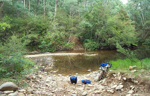
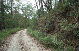
Photos : Crossing the Goulburn River pre flat tyre, cruisy scenic cycling at the top of Lazarini's Spur.
28.6km - Passed the camp on the left which was prone to some annoying black ants. Huts were looking good. A real road 1.1km later and a 6km uphill towards Mt Skene.
34.2km - Got to a Barkley River Jeep Track sign but knew there was a better entry ahead. Was getting cold and air felt thinner. Bloke called Malcolm pulled up who was going to Jamieson who knew nothing of the huts but offered a ride. Took me 1km up the road to next BRJT entry. Absolutely stunning alpine country for the next 400m.
35.4km - At the top of a track which was labelled ‘very steep ‘ in the guidebook. It was rocky and ugly. Considered camping where I was in the breathtaking low trees, lush grass (lushest I've ever seen) and karmic serenity, but was wanting the hut experience.
36.5km - Bike had dragged me down the 'track' to a nice little grassed clearing called Rumpff Saddle. A maxi truck type vehicle with trailer was there but no humans. Another nice white gravel road.
37.6km - Pulled into Rumpff Huts area from a cruise downhill. A covered car was beside what was the biggest disappointment of my journey. Demolished huts. Instead of crying like a 26yr old baby I went into autopilot setting up camp. Was absolutely starving and was hogging into anything I came across in the panniers that could be eaten without preparation. I was going straight to Licola tomorrow. (full stop) Realised that I was suffering slight hypothermia and so checked my mentality and got changed and warmed up. Scrambled a power damper together and a fire and had rice and soup and peas. 3 degrees again by the time I'd eaten dinner at 6:30pm.
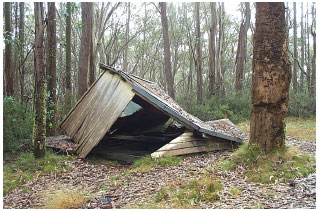
Thursday 29th March : Rumpff Huts to Licola
47.7km, 2h 47 min, max 42.5km/hr.
Roll on down.
Woke up and it was freezing - 4 degrees C. Had a bit of an attitude to match the cold weather. Dripping on the tent, and the end of the sleeping bag was damp from being up against the fly. Great.
Normal procedure for the morning. I realised that moments before I recalled yesterday when waking, I was mentally really good. Edith’s words of wisdom rattled in my ears “Treat every day as a new day”. I wasn't giving it that chance. Checked the damper that I had cooked last night and left on the meagre coals - cooked to perfection! Packed up the stuff as per usual routine but this time my thoughts were not on the usual where to today and how long etc.
I thought about how my grandfather had gone on his great adventure - WWII, how my mum and her sister had gone on a cycling adventure through Britain, how a relative had built a yacht from scratch, how some people climb Mt Everest, and about all the others out in the world who do the same sort of thing. People who decide that, well, it's time to get 'out there'. Then I considered what it must be like for my friends who were getting ready for work and an even less appealing schedule/routine, or for the people who don't have the opportunity to adventure. Just how lucky was I to be out doing my own thing, to my own schedule and at my own whim. I felt so good that I felt like crying. So I did.
I got on my way singing “It’s a beautiful day...” for indeed it was. The dripping wasn't rain - it was condensation from the fog which I originally thought had been an overcast day. The sun was shining through in slivers between the trees and I was on a mostly downhill journey into civilization where I could catch up on non cycling things related to the trip. “...don’t let it get away.”
Cruised the last 19km right to the doorstep of the Licola caravan park. Couldn't believe it was such a long downhill. It was on a dirt logging road which was a bit hairy (+ the 2 crazy downhill cows I spooked) and I got covered in dust. Licola has a nice feel to it - very country and warm even though it’s tiny. About 7km from Licola descending from the mountains there was a noticeable change in air temperature.
Bought and promptly scoffed most of a family pack of Arnott’s Classic biscuits and a small fruit and nut Cadbury block. Oh and a packet of chips while I laid out all my wet belongings to dry in the favourable sun. Had a hot shower (20c/5min) and watched the dirt wash down the drain. It felt good, but not quite as refreshing as the Knockwood dip. Must have been the soap.
Cleaned the pots and pans and put a load of washing on. Worked on journal and added updates to all the pages that required them. Was going to try to upload them here but I've been in and out of the shop all day asking questions buying food and asking for change etc. and I didn't want to push my luck. Had soup mixed with pasta for dinner and burnt my tongue. Polished off the rest of the chocolate and biscuits and went to bed late but very content.
Friday 30th March : Licola to Kelly Hut
52.5km, 4h 27min, max 51.5km/hr.
Uh... a long hill.
Up early. 6am now that I could utilise electricity. Typed up another journal entry and then did a mix of breakfast cereal so I wouldn't have to do it every single morning - a slow coming but good idea. Had breakfast and then got a message from Linda to see if I had worked out what I was doing and if I had been able to contact other BNT people. Neither, and had to scrounge change to call. Store didn’t open till 9am and they weren’t about to supply me with change. (They actually suggested that I ring reverse charge which I responded to with an open mouth, then an “Oh.”)
Went back to cabin ($33/night) and packed up gear for I had many phone numbers to test. Cleaned bike gears and chain which were bone dry and applied more lube. Tightened brakes and rack bolts again. I was going somewhere today, but I hadn’t worked out exactly where.
Made a heap of calls (going through 1 x $10 phone card) and then checked maps at the shop seats. Two blokes who had just pulled in to get a pie asked if I was doing the trail. I said "Yes". Check out their story - in Trail History (VIC).
As I pulled into the caravan park/store yesterday a bloke on a motorbike with a huge backpack (which I don’t know how he balanced) was getting fuel and getting ready to go to near where I had just come from. We chatted about bikes and general stuff and examined my map (for he had none) then he went on his way. I saw him the next morning when I had finished making a round of phone calls. He had come back down with his mates. He’d seen no logging trucks on his way up, but on their way down they came across the wreckage of a vehicle which had been collected by a truck earlier that morning. The man who was driving/owned that vehicle had been parrying me with the public phone all morning. I had been wondering why he’d been hanging around looking so preoccupied.
Left Licola just after 11am, the latest I'd left since the first day. 23km of bitumen on mostly rolling hills to the bottom of the range to start. Was actually in my highest gear on several occasions. Logging trucks were lurking around corners though, so I had to hold back on the corners.
Stopped at a particularly scenic turn on a hill overlooking the river and took some photos. As was not the norm I lay the bike on the left pannier. Took off. About a km or so down the road, cruising towards a bridge I looked down at the speedo to see I was doing 00.0km/hr. Hmmmm. Stopped and found the magnet sensor hanging from the wire with no capsule case. Another job for the incredible gaffa tape. Patched it up just fine. Could get by in this situation with no speedo by using the GPS, but it doesn't measure vertical distance in it's calculations. Very happy with gaffa tape - could have kissed it, but didn't.
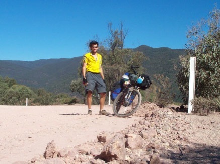
Photo : Hot, dry and dusty - I was right at home. At last sweating was efficient - even on such a long climb. Check the sky out... alright! I am a mountain man...
2km after repairs was the start of my climb back into the cool alpine regions. 15km of non stop slope in front of me is what I found. Along the way I found a spring which I wasn't looking for or expecting but glad I found as I could fill water bottles again. This was a concern as the country I had been cycling would really have earned a total fire ban rating. Within climbing another contour line on my topo map (150m) the air got about 5 degrees C cooler, the bush started to thicken, the trees were taller and straighter and then... the ferns returned! All of a sudden they were everywhere again. Weird. Stopped at Bennison Lookout which was good as they (whoever they are) had put a little board with a picture explaining what mountains you were gazing at. Most handy and a little bit of formality and education for the rest break.
Once I reached the Tamboritha Saddle I was very happy for the hill had ended and I was able to cruise down a good slope towards Kellys Lane. The uphill wasn't so bad as when you get into the climbing rhythm you get comfortable. The road wasn't like a cattle grid either - only very dusty with great rumbling lumbering trucks.
Kellys Lane off to the left 4km later and I had returned to what was becoming familiar territory - the alpine. This was absolutely picturesque country and even though I was in a bit of a hurry I stopped several times to look around and take photos. A crystal clear stream gushing down a short waterfall surrounded by lush alpine grass filled my thirsty water reserves and vision before I continued.
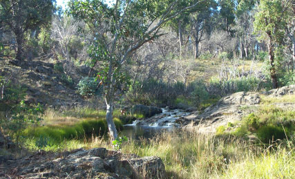
Went right past Kellys Hut. Thought It was McMichaels Hut. Up about four sharp and steep little hills too. I was on a 'no push' day so absolutely tested the 'hernia stability' over these. A horse in a float said nothing, but the fella driving this privileged beast said I'd missed the hut and so had to go back down those hills. A somewhat wasted effort.
Nice little hut, but in need of a floor and perhaps some larger windows for light. Had seen plenty of life judging by the bottles on a rafter, the depth of the ash in the fireplace and the entries in the visitors' book. A beautiful setting looking up and across a thickly grassed valley. Got a fire ready and unpacked and arranged gear. Had carried a can of baked beans all the way up that 15km hill and so I was going to eat every last one tonight. I get to lug the can around until the next rubbish bin.
A couple on horseback arrived at the hut 15min later and we started talking. They talked a bit about the area and had a peep in the hut which I was squatting in (like Witchy in James St) and they had a look at my map trying to work out where they'd been that afternoon on their ride. I told them about my plans and they said a fellow they'd been riding with over the last few days knew a lot about the BNT and local tracks - John was his name. I couldn't believe it. The local who I'd spoken to on the phone before leaving Healesville was just over the hill! John had said I might catch them at Wonnangatta station where they'd be riding if I made good time on my bike. I'd done a huge detour and they'd decided to come up to the Kelly Hut area before returning to Narbethong! Unreal. I made plans to visit in the morning before they left.
Cooked dinner on the fire (BB and rice) and then wrote replies to some emails from kids in my year 7 class last year. Had another damper made and it was cooking but again burned it with coals far too hot and a cook far too preoccupied. When will I get it right?
Rolled tarp out fully on old horsehair mattresses and attempted sleep. Several minutes into the darkness and silence I hear noises. One of the BNT reps I'd rung in the morning had said "Kelly Hut is a nice little hut if you don't mind rats." Shit I hate rats. Especially when it's all quiet, there's a smell of food in the air and I'm lying down in their territory. Checked food was secure. Only food out was my failed damper. If they could get any sort of meal out of that - good on 'em. They tried very hard.
I got paranoid and slept with my torch in my hand and yelled and slapped the tarp whenever it sounded like they got a little close. Which was every 4 minutes at least. I busted one on the table attempting the damper and was relieved to see only a mouse. You make a lot of noise for such a little creature. They could not get on or move far under the tarp without being heard and for this I was moderately happy. Still, I reckon I only got about 2hrs sleep in one block. There were only two that I could really identify, but it sounded like five, and that's too many to be able to keep track of at once. Yes, I did consider pitching my tent on the horsehair mattresses, and no, it didn't seem like a strange idea at the time.
Who wants to stay in a hut?
Saturday 31st March : Kelly Hut to The Pinnacles
57.4km, 4h 27min, max 41.5km/hr.
A short and easy day?
Up at dawn after such a wonderful sleep. Reheated leftovers on stove and then quickly packed and put gear into side room (yes, this hut had two rooms!). Rode empty off to the horse paddock (up those wretched little hills) to find John and the crew.
We talked about the BNT and the tracks so far. Funnily enough he asked how I found the going on Hugh's Track. I told him fairly bluntly. He said he'd been up there some months back and couldn't believe it. Attempted going up in his 4WD for a few hundred metres and then drove around to go down instead. His vehicle still has some scars. Bogged to the axle he got on one mushy bend. I told him I'd done the same momentarily... in his ruts obviously!
He queried whether I was heading to Wonnangatta Station. There is a real history about that place, but unfortunately I won't be seeing it this time. He recommended dropping by at Moroka Hut on the way to see the Pinnacles and the lookout there, a restored hut at Eaglevale (Harry Smith Hut), and going down Billy Goat Bluff Track. At last I had some direction based on good local advice for the next few days. I asked what BGBT would be like as I had been warned it was worse 'cycling' than Lazarini's and Terrible. He said "If you can get up Terrible and Lazarini's, then you can go down Billy Goat. It'll be as steep as Lazarini's and just as rocky, but you'll be going down". Good-o, I'll give that a go.
John also reckoned that MTB was the way to do this area of the trail and perhaps all of the trail. This surprised me from a horseman, but his logic was straightforward.
a) easier camping and detouring as you have no stock restrictions;
b) no animal maintenance, feeding, watering and gear to worry about and carry;
c) faster on downhill sections and through built up areas.
You just need to be able to pedal really... and balance... and push... and drag... and fix... and... A lot of skills needed for both alternatives of transport. I talk to my bike occasionally but it can't look at me or give me a friendly nudge.
As they were pulling away a 4WD pulled through the gate towards the horse paddock. Two blokes and two horses - it was Alistair and Peter. Chatted for a few minutes and then before leaving Peter reminded me of his previous advice : head down, butt up and pedal.
Back to the rat hut and loaded gear. In no hurry at all. Wanted to go back along Kelly's Lane to see that country again, but didn't want to retrace my path if possible. You never know what's round the next corner... unless you're only a few km into a 15km hill! Only problem was that meant going up those little hills again. Curses - with a full load as well. My legs were feeling a little weak and I planned to have an easy day of about 35km to the Horseyard Hut camping area... to sleep in my tent.
I went north to rejoin the main road (3km) rather than retrace. Turned south to Arbuckle Junction and all I could think of was Garfield. No effort to pedaling - rolled down hills without bothering to change gears or accelerate, and pottered along in the lowest gear even up the gentlest of slopes.
Plenty of 4WD with floats on the road in this area. A beautiful spot for the gee-gees...and MTBs. Great views NE 6km past Arbuckle. Another plaque board similar to Bennison with arrows and squiggly horizontal line and the sort. Could see and identify Mt Hotham, Snowy, Kent, Hart and a few others. Often at a lookout I look to see if I can spot the road I am going to follow in the distance. Not this time as the road curved around to the SE. Topo map said mainly downhill and it was to Horseyard Flats.
A note on MTBing on lonely gravel roads : The outside of the curve up on the camber tends to have less rills and rocks, but is often a looser soil. Care needed but much more comfortable. This means half the time you're on the wrong side of the road on a bend... make sure it's a lonely road! Not advised in the learn to drive book, but recommended by means of my groin, patience and mental well being. I always let the vocal cords get loose on those terrible rills - it just seems to make you feel like you're making a point. You can also end the sick goat sound with an obscenity aimed at the road as well. That makes me feel better.
Stopped in at the sign to Moroka Hut. Walkers only and 300m in. Placed the bike just in on the track and started walking. 450m in (I run these sort of reps - I know how far it is!) I came to a quaint little bridge and then the grass thickened. I had been banging my hand on my stiff leathery pants (a graduation from cardboard) to ward off vipers. Had EPIRB with me but had not brought bandage from side of bar bag. Safety whispered in my ear "no further", so I told the bush I hoped the hut was nice and turned and banged my way back to the bike. Safety then said "Well done - after all, a hut's a hut - it could be a Keppel or it could be a Rumpff". Jannet had said it was worth a look so I'm thinking more Keppel. I'm sure I'll see many more.
Had made good time thus far and so decided to stop at Horseyard Flats (2km along the road which wasn't accounted for on the map) . There was a hut here with a fridge, sink, chairs, bunk beds and windows. Not bad, but no Keppel. A sit down and stop lunch - how novel! Made some tea and tried to make power damper in a pot oven. It was a trial method so I wasn't expecting anything great. Only burnt it slightly but due to lack of sultanas it didn't have that zang to it. Plenty for snacks over the next two days. Had a half hour snooze before continuing. Aimed to make it to the creek crossings below the Pinnacles climb as a camp. More than I had originally thought, and was feeling reasonable after 46km.

A 4WD coming into camp for the Sunday pulled in as I was leaving. The river was handy at the flats, but I though I'd stop at the creek a few km away to refill water bottles. There were two ahead. There were not two ahead - only one that I flew over and wasn't about to sacrifice my momentum to.
It wasn't far to the end of this road so I plugged on towards the Pinnacles. Distances on the map were slightly out here, but the slopes were fairly gentle for an approach to a very high (1445m) pinnacle. Said to myself "3km up this 5km road or 4:30 pm - whichever comes last". A cyclists dream - a moderate downhill section with some gentle rises - and all of a sudden I was at 4.5km with not far to go.
Rode right up to the outpost cabin at the Pinnacle. Pushed my bike up a short rocky slope to get a photo of it and ranges in the distance. On top of the world here! Stunning views all around. Visit here. Walked up to the lookout which has a room where a fire spotter works a couple of months a year. Chatted to him for a half hour, took some photos and... Yes Optus! Well in fact... No Optus! Signal was received but the phone only has a range of about 35km. So I had full bars on the thing and it wouldn't send or receive anything. Bummer. I had a list of people I was going to ring and brag to. See an explanation in Trail History (VIC)
Filled up water bottles with great water from the bloke's tank (very generous) and rolled 400m down the road to a alpine-ish camping spot I'd seen just before the top. Set up camp, hogged into tuna pasta and typed up some journal and transferred photos (a nice way to rehearse the day). Outside the moon and stars were bright and the air was as still as a dusty old cupboard.
Really happy with today - the people met, the path taken, the distance achieved, the rest break, the surprising easy up, the views and atmosphere on the Pinnacle, the information from the fire spotter, the meal and the great camping spot. A tops day!
Sunday 1st April : The Pinnacles to Eaglevale
28.4km, 2h 57min, max 35.5km/hr.
The bell tolls for thee.
A bit windy was what I'd find this morning's weather to be.
I'd hoped the stillness would have continued - for a sunrise I wished to see.
Alas - no use, but at least it was warm, which seemed a little odd for such heights.
Typed up some journal stuff after my brekky, while I waited for a peep of sunlight.
--
Packed up yet again then had a stretch on the tarp, with a little yoga as well.
Watched six... make that nine, 4WDs cruise by - to the Pinnacle I could tell.
Two to three humans in each (what an odd way to trek) ...Sunday drivers you bet!
So I hopped on my bike ready as rain - to conquer Billy Goat Bluff Track I was set.
--
Bloody steep, with big filthy rocks and some pushing I was not quite expecting,
This time of the morning to get 'down' a track - wasn't long before I was detecting...
This was going to be tough - like John surely said "It like Lazarini's, only down"
So I thought 'Hang on... This'll be just great - descending should have no frown"
--
I got passed by a rover who's driver offered me a lift, to which I politely declined,
For this was a chance to haul down a steep path -the pleasure was going to be mine.
Stopped at the helipad (just a bare patch of dirt) a little over half the trip done.
Took some photos and ate jellybeans and dried fruit - the former decidedly 'yum!'
--
My rack's welding got broke , and I was baffled as how to fix it - gaffa? no wire'll do!
For a problem like this will get bigger real quick, if you hurry your actions too.
At the bottom I found that my arms were quite sore from taking all of my weight...
8km down can cause quite some wear - like 3mill. off my rear tyre tread mate!
--
The Billy Goat Track had quite earned it's name this morning for it was tough,
Some more casual riding I wanted to see, for of hills I'd had quite enough.
One thing I was glad - that I'd tightened my brakes this morning before I had left.
For failing to do this , just one simple thing, could have seriously made me bereft.
--
Pushed on a few more K's - I was hungry for lunch - but had a big goal in mind.
To make it to see Harry Smiths Hut before dark - but to my body I'd been unkind.
I'd gone far too hard in previous days and my body was needing serious rest.
So I struggled to Eaglevale and at 3pm halted - no more for the day I confess.
--
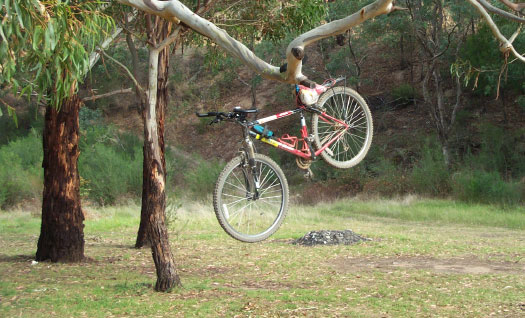
Hung up me bike by the Wonnangatta River - so picturesque and good for a swim.
Made 'supa meal' and did some relaxing things, then to bed... couldn't wait to get in.
Tomorrow is there to see Mr Smith's Hut, and to head down the river to Dargo.
Where I'll have a whole day to ignore my good bike and sink a couple of larger-o's.
Notes:
Parrots - Rosellas (Arnott’s tin type) often fly out of nowhere on parts of the trail. I didn't think I'd see any in these parts but they are just about the most common bird I've seen.
Updates... of the site will be made roughly weekly. You've got better things to do that check this site every few days looking for new stuff. If you're on the mailing list you'll know when because you'll get an email... so get on that mailing list!
7C - When I got to Licola I had a hot shower and actually used soap! Thought you might be happy about that!
5H / 2FJ - Can you send me a digital photo (via email) of you doing something related to this trip so I can put it on the Learn pages? (Or any other tuned in class for that matter)
Bruce - Thanks for that message on the voice mail. It really was a nice surprise, and good to hear a familiar voice on the top of a hostile mountain.
Steve - As soon as I turned down Kellys Lane I thought that you'd absolutely love this place for a cruise around on a mountain bike. I was pretty buggered but I was just looking around in awe. We'll have to come down and MTB around here.
D/J/B/G - Won't be doing much running with the Achilles problem. Hope those km reps are hurting. I'm working on the old aerobic base quite significantly! Call me 'Lance' if you wish.
Helen - get those gee-gees in that trailer-float-thing and bring them into the alpine wilderness around Wonnangatta. This is mega horse riding country.
MTB Touring Advice - Always check your brakes (particularly rear) evening and morning and also your rack bolts. These have a habit of loosening ever so slowly. I like the feeling of having a slightly tighter rear brake compared to the front brake. Also, always look behind you after leaving a place you have just taken photographs at - you probably haven't forgotten anything - you may just see that it's a better angle/shot/view from your new position!
Week Two
March 26, 2001
“Are you gonna go my way?”
Lenny Kravitz
